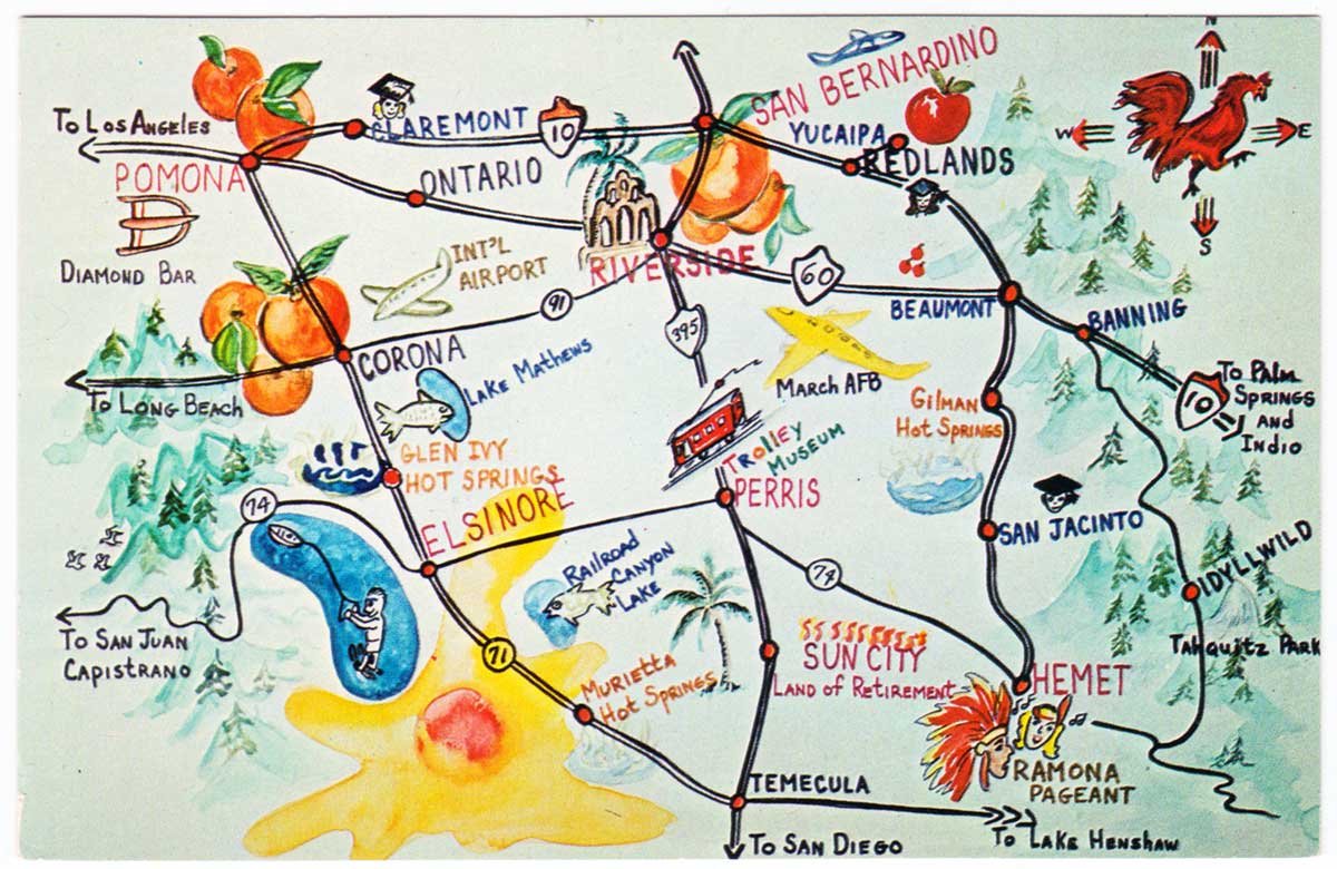
Greetings from the California Inland Empire
We’re not certain of the exact year, but this postcard appears to be sometime during the 1950s. Based upon “Int’l Airport” being used for notating Ontario Airport, it’s likely post-1946 — the year Ontario Municipal Airport was re-named Ontario International Airport. Likewise, the lack of Lake Perris means it’s pre-1974.
Note also the current-day routes for the I-15 and I-215 freeways are signed as 71 and 395 respectively and the 60 Freeway between Riverside and Pomona appears to follow the old Mission Blvd. route, which again, likely dates the card to the late 1950s.
At any rate, the postcard hails from a time when Inland Southern California was better known for its orange groves and outdoor recreation rather than for explosive suburban growth.
For those interested, the back of the card reads:
This colorful “Empire” extends into the San Bernardino, Riverside, and Los Angeles counties.
Postcard: Color Photo by Luis and Virginia Kay / Columbia Wholesale Supply, N. Hollywood, Calif.