2000- California Historical Landmark No. 20 located in Riverside (RXSQ)

Riverside’s navel orange

From a recent edition of the Los Angeles Times:

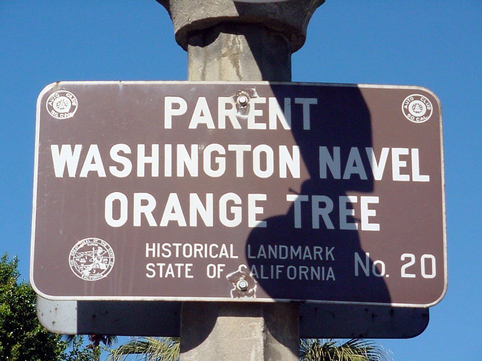
The bronze plaque tells the tale: “The most valuable fruit introduction yet made by the United States Department of Agriculture.”

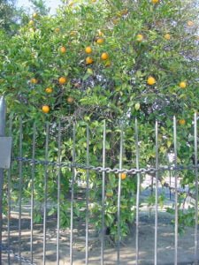
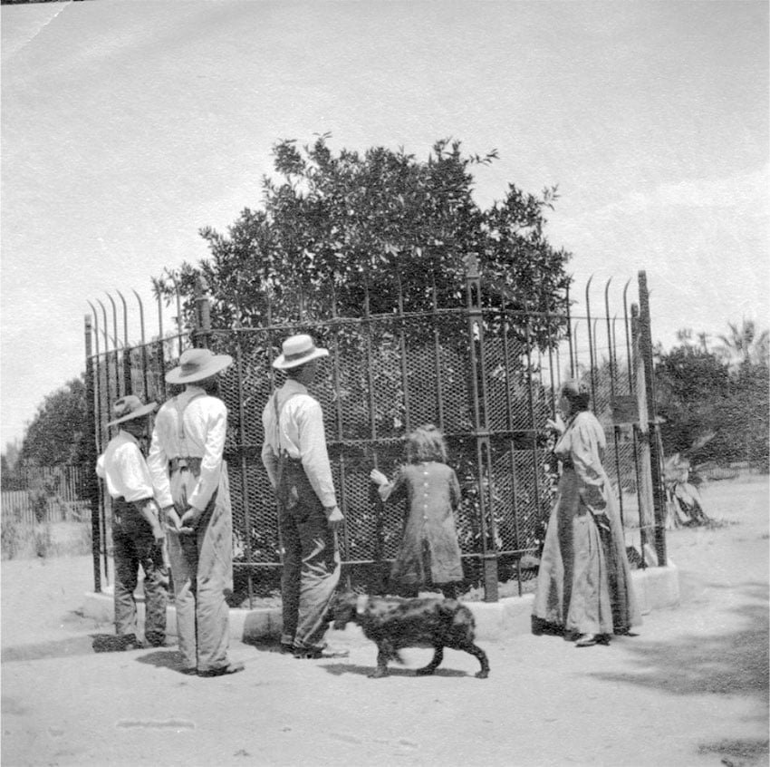
And there, at Magnolia and Arlington avenues in Riverside, stands the last of California’s original Washington navel orange trees, enclosed by an iron fence, looming over the plaque in the summer sun.

It is the tree that launched the storied citrus industry in the Riverside area, an industry that helped shape the world’s view of Southern California as a tropical paradise in the early 20th century.

Los Angeles Times – August 5, 2004

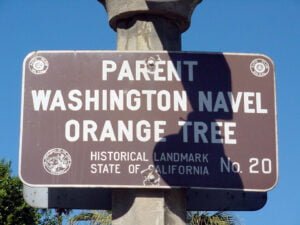
For those who don’t know, from this very navel orange tree (and a second sibling tree that died long ago) descended every Washington Navel orange tree in California, spawning California’s highly-successful — and very lucrative — navel orange industry. Some historians have referred to it as the second “gold rush” for California.

Related


12g-riv-2011c-magnolia-6570-014-3ac-500.jpg

Image 59 of 60

The Riverside location received a mosaic designed by Susan Hertel and Denis O'Connor. It depicts Luther and Eliza Tibbets and the parent navel, with Eliza sustaining the tree with her dishwater. At top is the Mission Inn.

Sources: Los Angeles Times (LAT-20040805), California Citrus State Historic Park; NOTE: Published dates for some online versions of newspaper articles cited may not match their archival source date.

2024 PAGE UPDATE: Added additional info/context; added link to June 2019 news article; removed outdated link to photo gallery and added 2011 photo slideshow.

Similar Posts

  • |

    Greetings from the California Inland Empire

    We’re not certain of the exact year, but this postcard appears to be sometime during the 1950s. Based upon “Int’l Airport” being used for notating Ontario Airport, it’s likely post-1946 — the year Ontario Municipal Airport was re-named Ontario International Airport. Likewise, the lack of Lake Perris means it’s pre-1974. Note also the current-day routes…

  • |

    Postcard: Beautiful Riverside, California

    Here’s an aerial view from approximately 1960 over downtown Riverside. The view is looking north from Fourteenth Street, with the intersection of Fourteenth and Market/Magnolia at bottom-left. At top-right is the then relatively new Riverside Freeway (Highway 91), with southbound off-ramp at Seventh Street (now Mission Inn Avenue) and southbound on-ramp at Ninth Street (currently…

  • |

    Downtown SD part deux

    An excellent article regarding the recent residential building boom taking shape in downtown San Diego (a not too distant topic here on this very site) appeared recently on the San Francisco Weekly Website. Writer Matt Smith surmises that San Diego and residents themselves are finally beginning to realize both the need and desirability of some…

  • Riverside Roundup – 02/08/2009

    Interchange project put to bed 200960/91/215 interchange After nearly 5 years of construction — and 20-year wait for local commuters — Caltrans says it has finally closed the books on the 60/91/215 interchange/freeway project in downtown Riverside. The final tally for the rebuild comes in at $437 million, approximately 40 percent over initial estimates and…

  • Old Riverside Foundation’s annual Vintage Home Tour

    Celebrating Riverside’s citrus heritage is the theme of Old Riverside Foundation’s 21st annual Vintage Home Tour, which takes place this Saturday, May 19. The self-guided tour showcases four privately owned homes near Victoria Avenue in the city’s historic orange greenbelt as well as a downtown church with strong citrus ties. The four homes are the…

Leave a Reply

Your email address will not be published. Required fields are marked *

This site uses Akismet to reduce spam. Learn how your comment data is processed.